
1st Battalion 6th Infantry, US Army, Vietnam
|
Map Information and Selection Page
1st Battalion 6th Infantry, US Army, Vietnam |
| Note: this
is the CD version of the Map Information and Selection Page found on the
1st Bn 6th Inf web site. The italicized
links to other map pages and map rooms only work on the web, while underlined
links are on this CD.
**Click this link to go to a different directory on the CD that contains tactical 1:50,000 topographical maps of Vietnam from Da Nang to Quang Ngai** |
Map Information
Tactical operations in Vietnam for Allied ground forces were coordinated
using maps
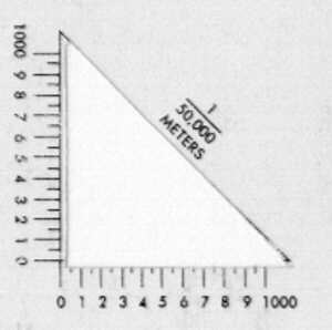
that displayed terrain, vegetation, and structures on a scale of 1:50,000.
At that scale, one
and 1/4 inch represented approximately one mile. Aviation units
generally relied upon
larger scale maps for their more extensive operations.
Tactical maps for use in Vietnam were created and printed by the US
Army Corps of Engineers
Army Map Service (AMS) [later known as the Army Topographical Command
(TPC)]
and distributed to combat units. Readers should be aware that
at least three versions of tactical
maps exist for Vietnam. The earliest editions were replaced in
the 1960s with maps by the Army
Map Service. The Defense Mapping Agency revised these 1:50,000
tactical maps of Vietnam
when they created the Edition 3-DMA in the 1980s. The revised
edition maps can be ordered
today and show the significant changes in Vietnam since the end of
the war.
Although the maps represented the state of the art at the time, errors
sometimes were evident.
Prior to the advent of the space age (and the incredible accuracy of
the Global Positioning
System(GPS) to the nearest 10 meters), map locations during the war
were sometimes difficult
to determine with precision even when the terrain was not flat.
Exact locations were crucial
when a unit called for artillery or close air support.
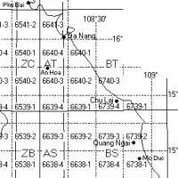 |
Virtually all of the tactical operations conducted by the 1st Battalion 6th Infantry during the war occurred in the area identified by map Grid Zone Designation 49P. The 100,000 m. square identification letters included BT in the northern part of the TAOR (generally from the so called "Rocket Ridge" west of Chu Lai all the way to Da Nang) and BS in the southern part (generally from Chu Lai southward). The AT and AS map prefix areas began in the mountains approximately 30 miles inland from Chu Lai, while the ZC and ZB areas were ever farther to the west. Visit Vic Vilionis's map room link for a large size view of this grid and a complete view of map grid identifiers in all of the I Corps area of northern South Vietnam. |
Map locations for tactical operations along the coastal plains and in
the foothills of the I Corps
in northern South Vietnam were identified by a six digit grid coordinate
preceded by two letters,
usually "BT" or "BS." While a complete grid identifier for tactical
operations could be complex,
(e.g. 49 P BS 648 936) the more usual practice was to use only the
prefix letters and six grid
coordinates to be accurate to the nearest 100 meters.
 |
 |
Map Legend - explanatory list of symbols on the the tactical 1:50,000 maps
The map legend and other map data generally were the same for each of
the maps prepared by the
Army Map Service. Use this link to view the map
legend for tactical maps (1:50,000) used by the
1st Battalion 6th Infantry.
Map Selections
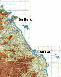 |
Map ND49-01 (1:250,000).
This link to a map scanned by Jim Henthorn shows the coast of Vietnam from
Da Nang southward to Quang Ngai. Near the bottom of the map, the
tactical area of operations (AO) for the 1st Battalion 6th Infantry in
1970-71 can be seen between Chu Lai and Quang Ngai. If you link to Jim's
map room and then click on the desired area of his maps,
a full scale map becomes visible. This particular map is a very large file that takes time to load, but is well worth the wait. Jim's map project is a superb site for large scale maps of Vietnam, Laos, and Cambodia. |
 |
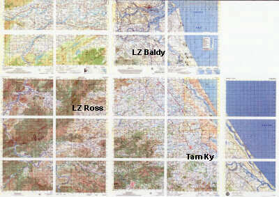
A map room created by Al Simms (radar technician, 1st Bn, 14th Arty,
Americal Division 1968-69) has extensive information about fire bases in
the areas around Chu Lai. Click on the map at left to link to a large scale
map of the LZs and FSBs.
Click
on this link to go to Al's excellent map room.
|
 |
The link at left shows the map selection method that Vic Vilionis has used in his map room at the 7th Marines site. The 1st Bn 6th Inf operated in these areas in 1968 and '69. Use this link to enter the map room, and then click on individual map segments to see full size 1:50,000 tactical maps of the southern I Corps areas with map data from 1965 to 1968. His superb web site is an excellent source of information about US Marine operations in areas later occupied by the 1st Bn 6th Inf. |
During late 1969 and early 1970, the 1st Bn 6th Inf operated in the areas immediately west of Chu Lai.
|
|
||||||||||||||||||||
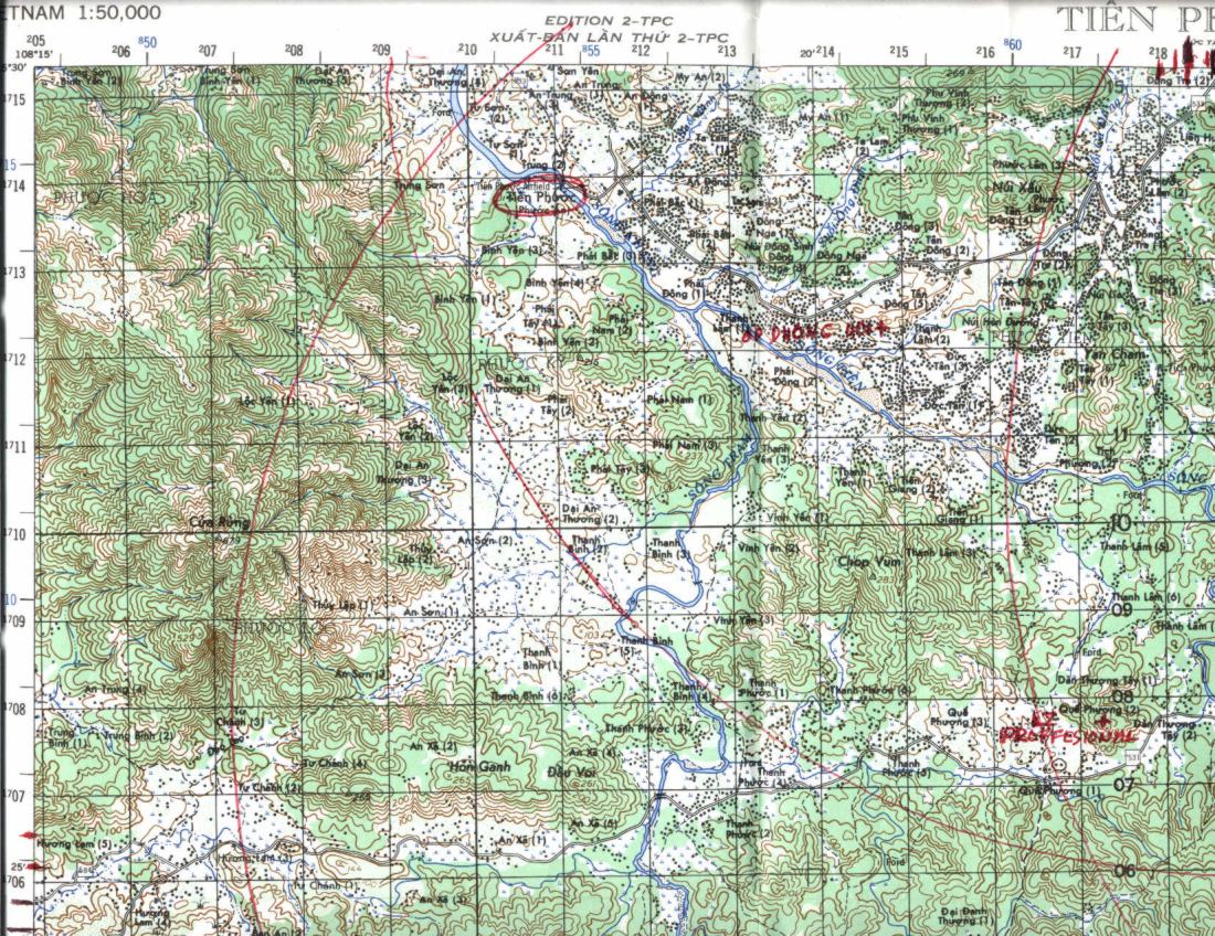
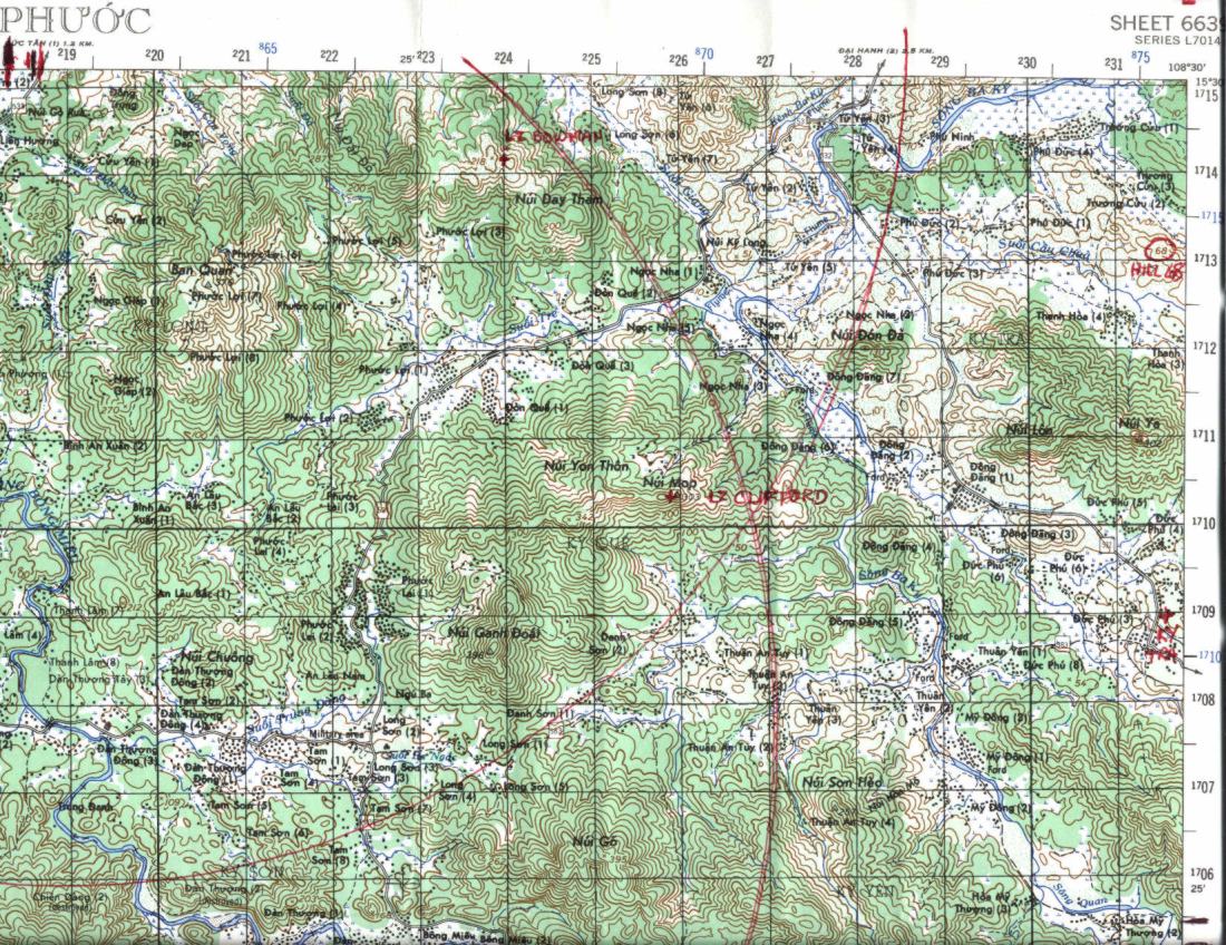
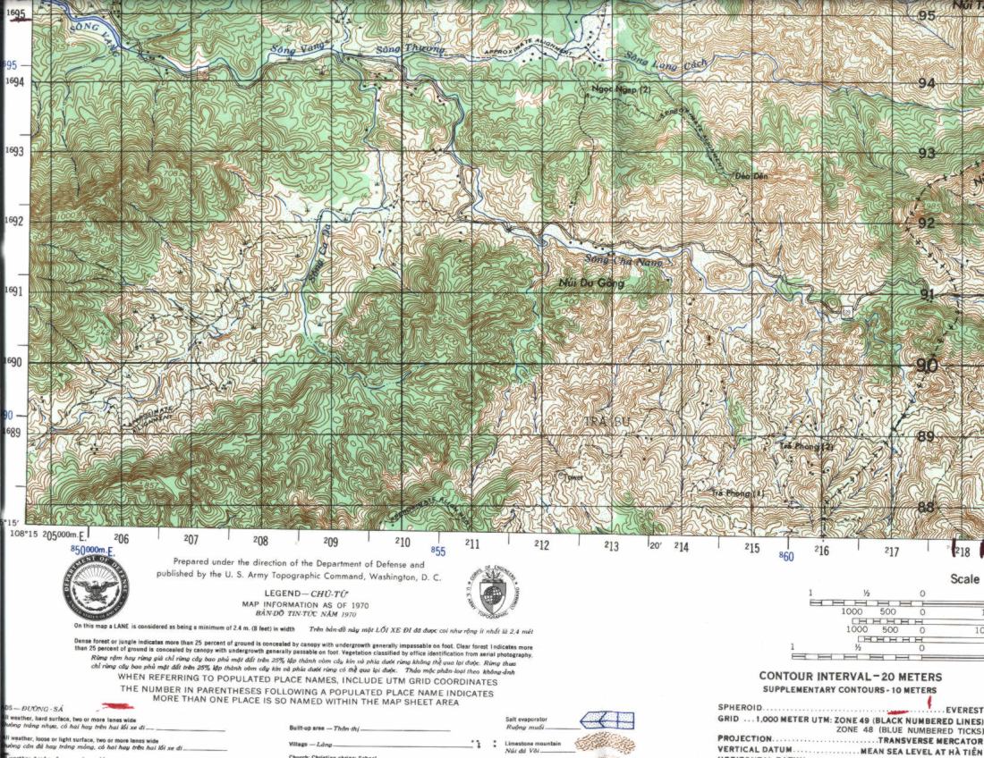
Sheet 6639 - I Tien Phuoc
|
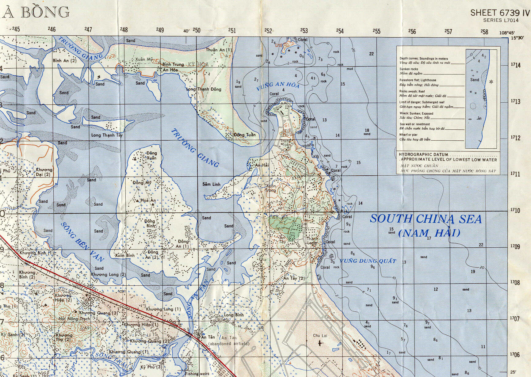
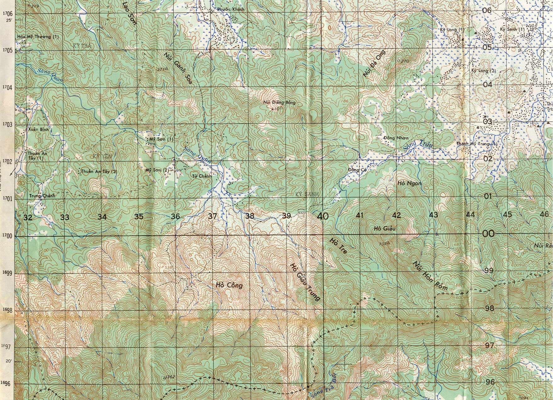
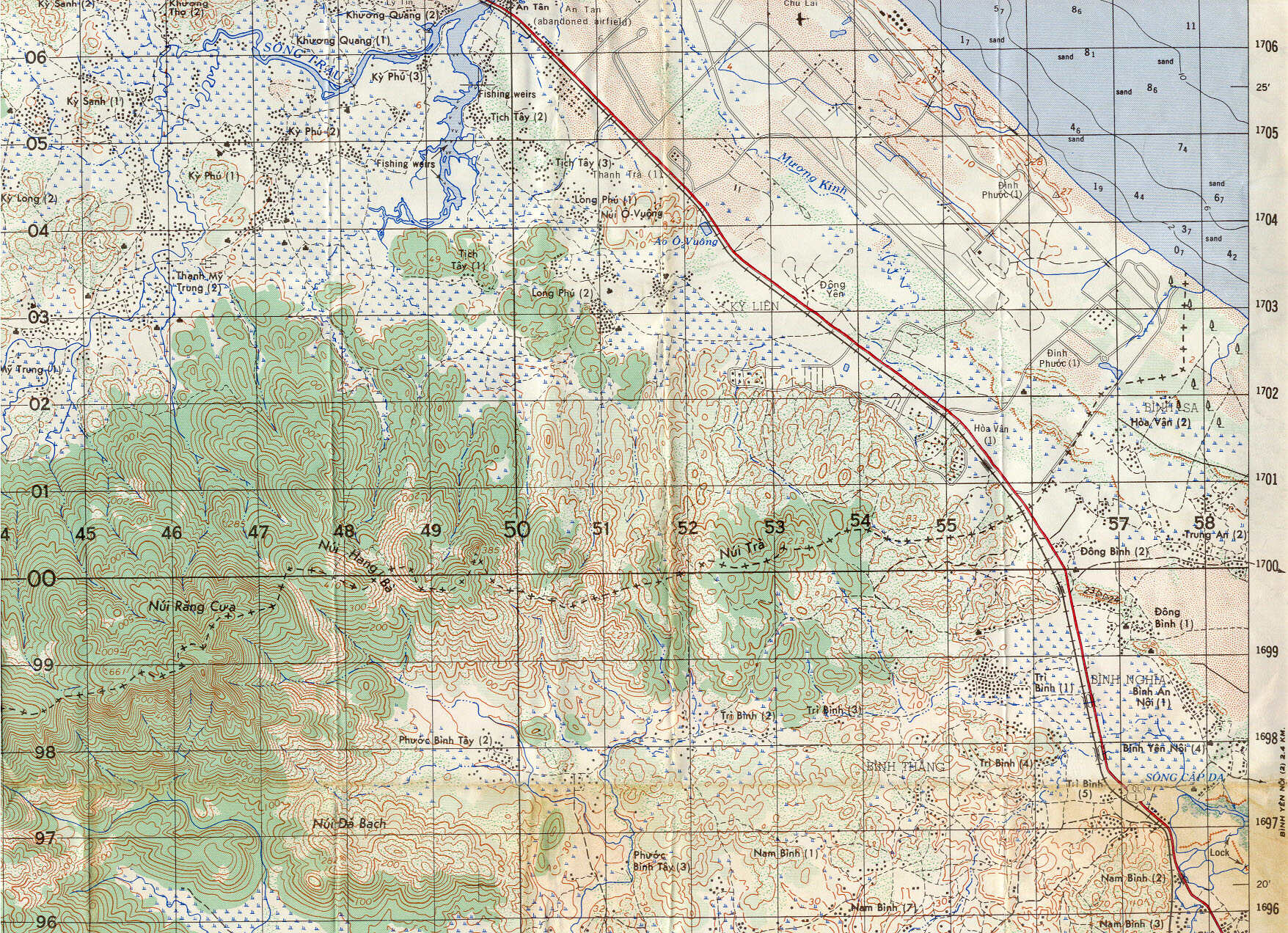
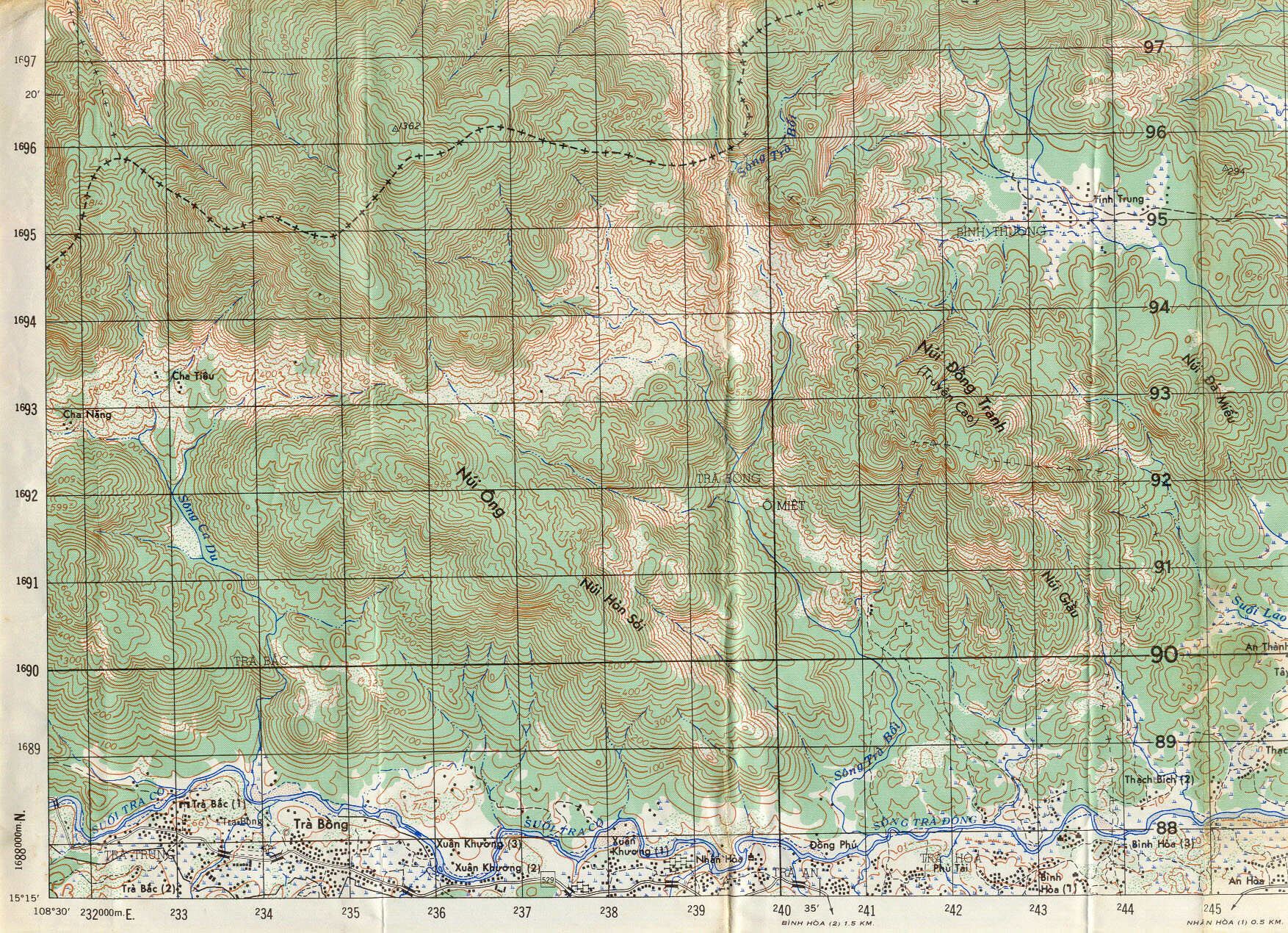
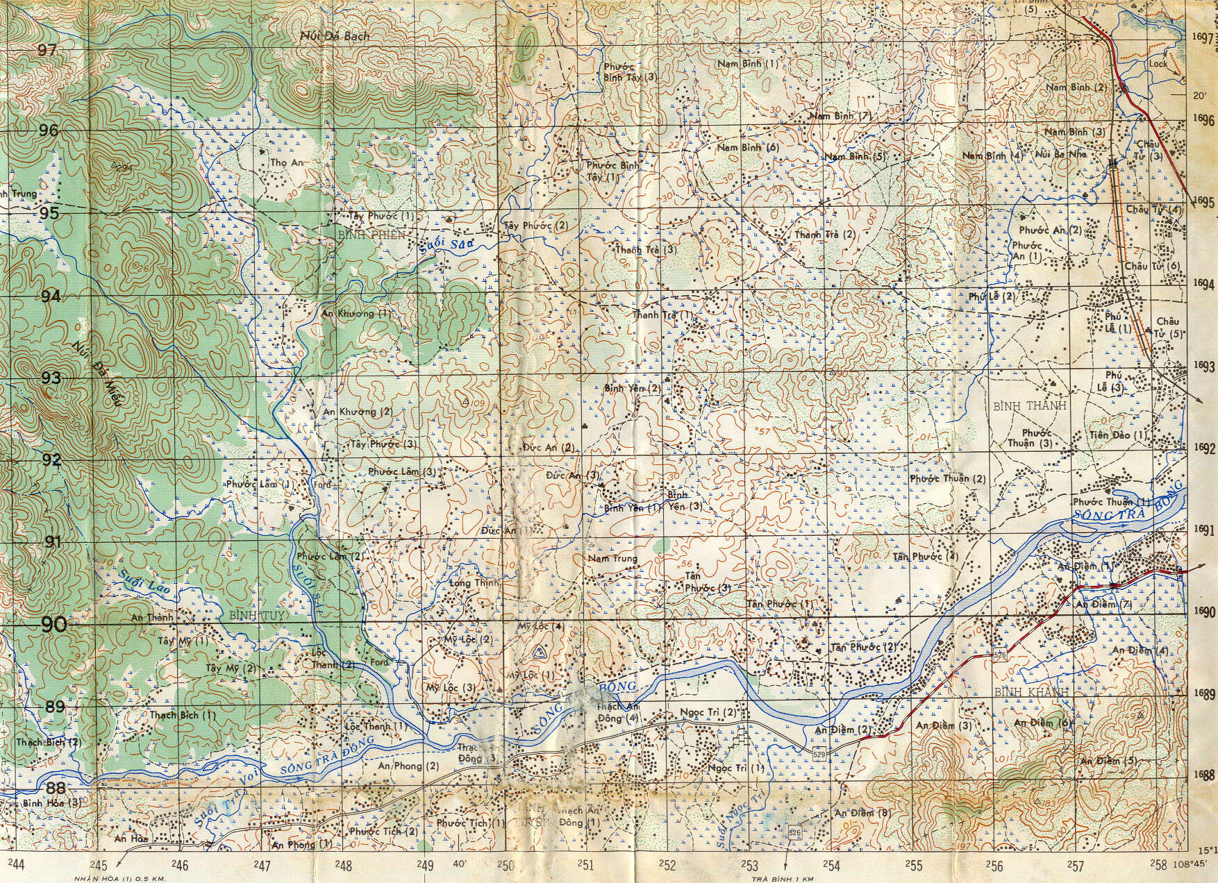
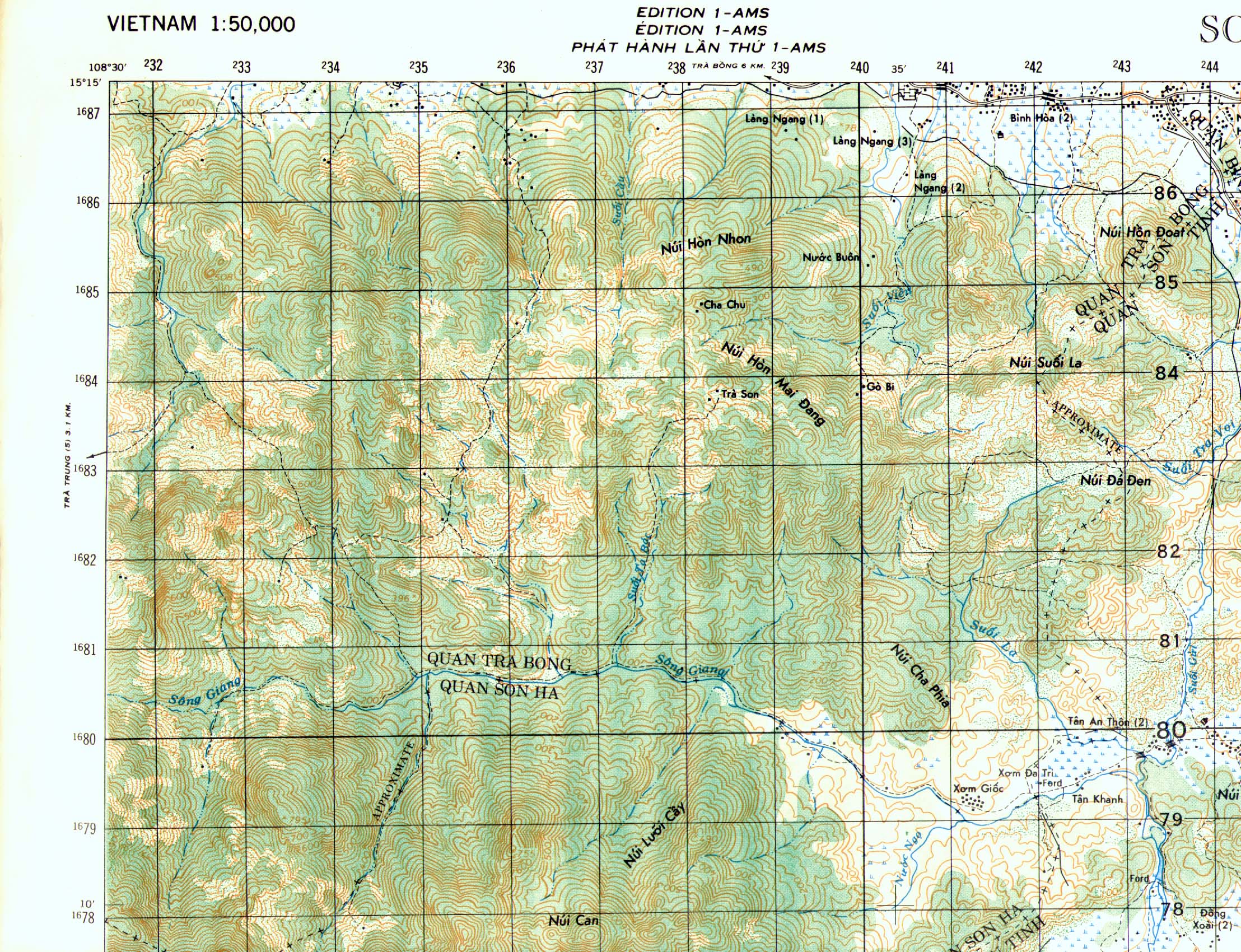
Sheet 6739 - IV Tra Bong
|
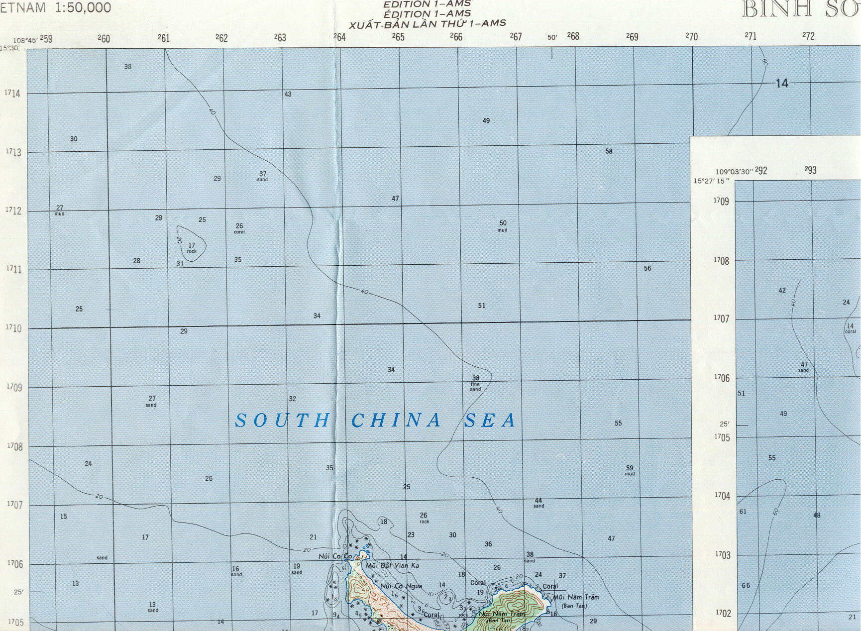
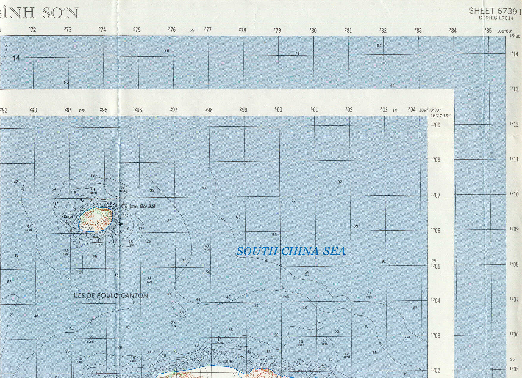
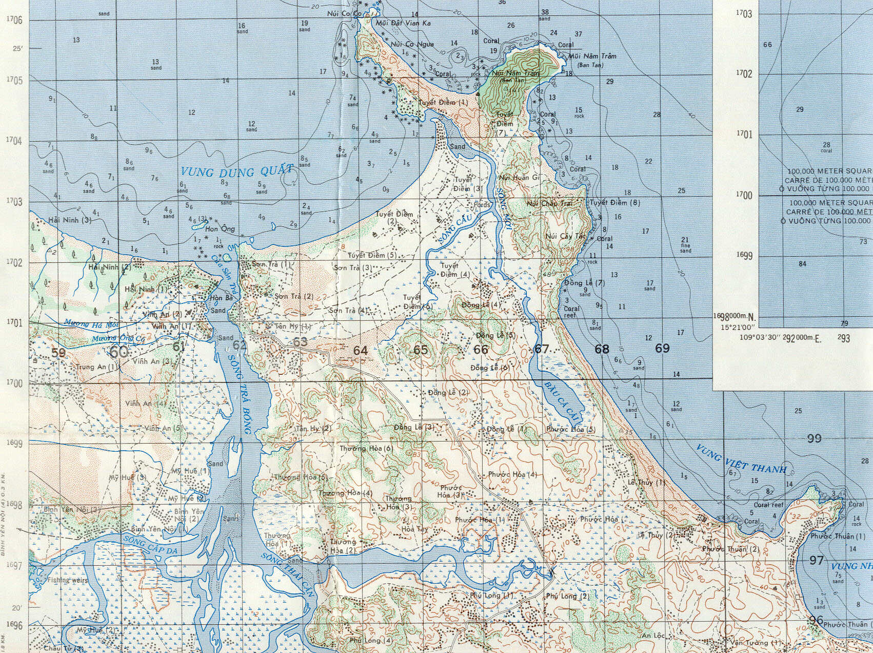
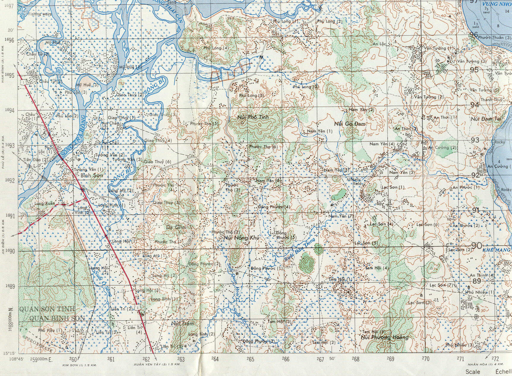
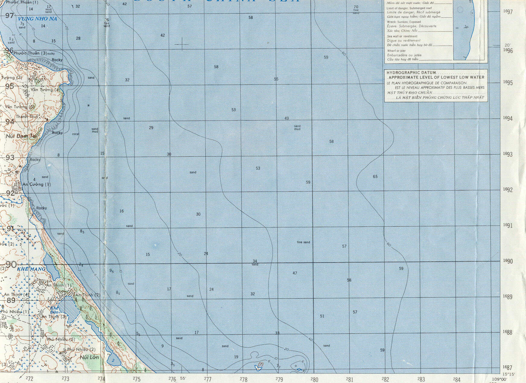
Sheet 6739 - I Binh Son
|
||||||||||||||||||
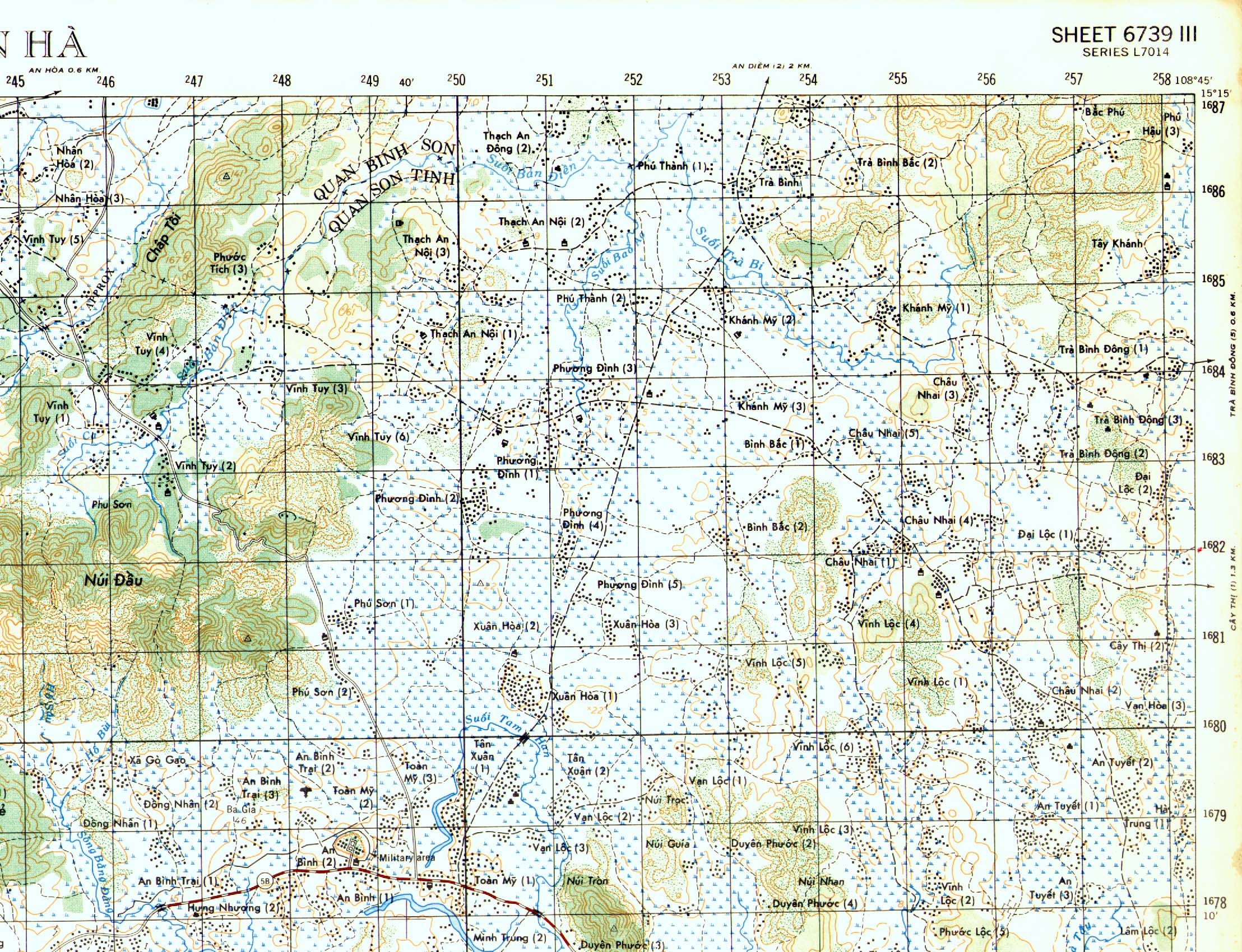
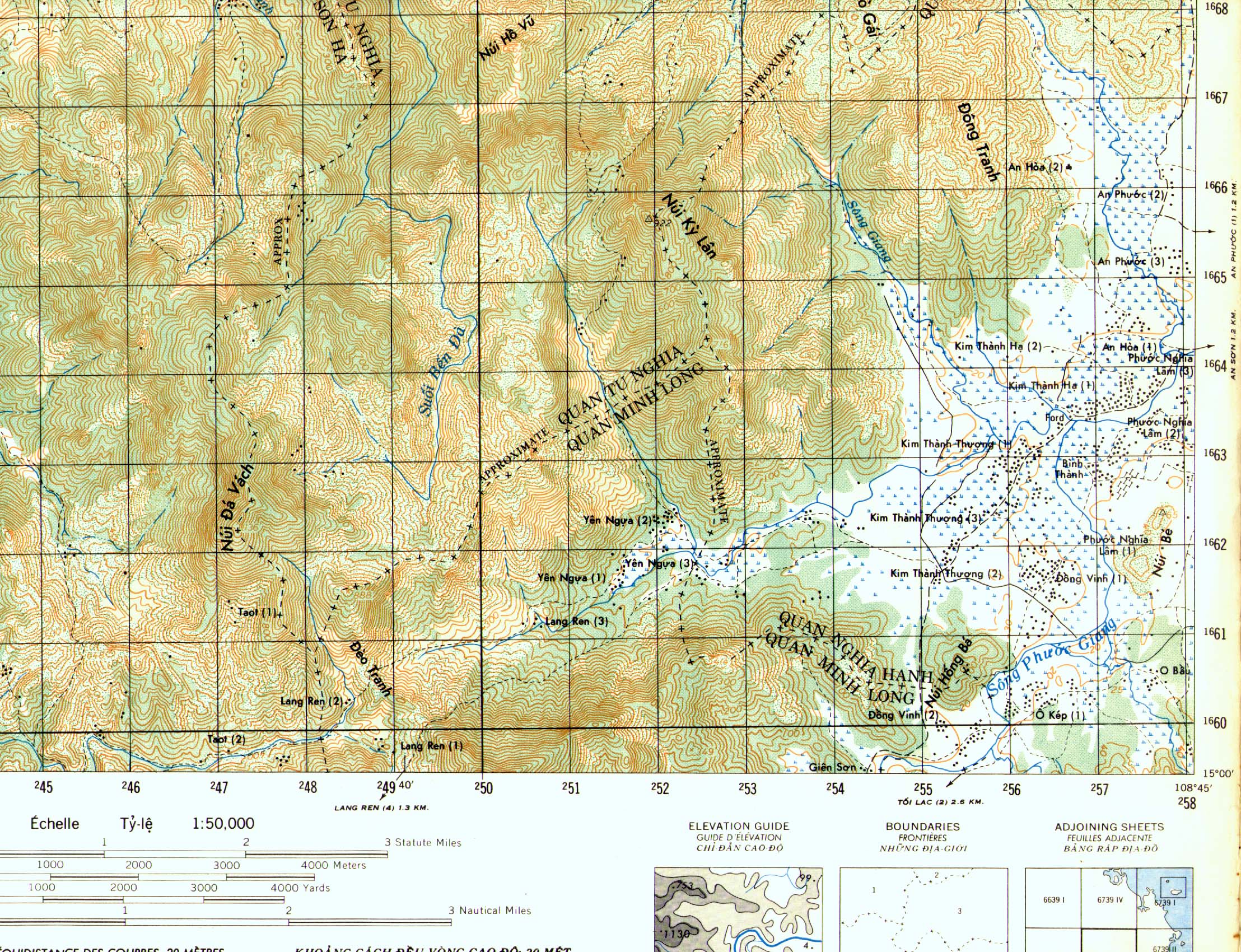
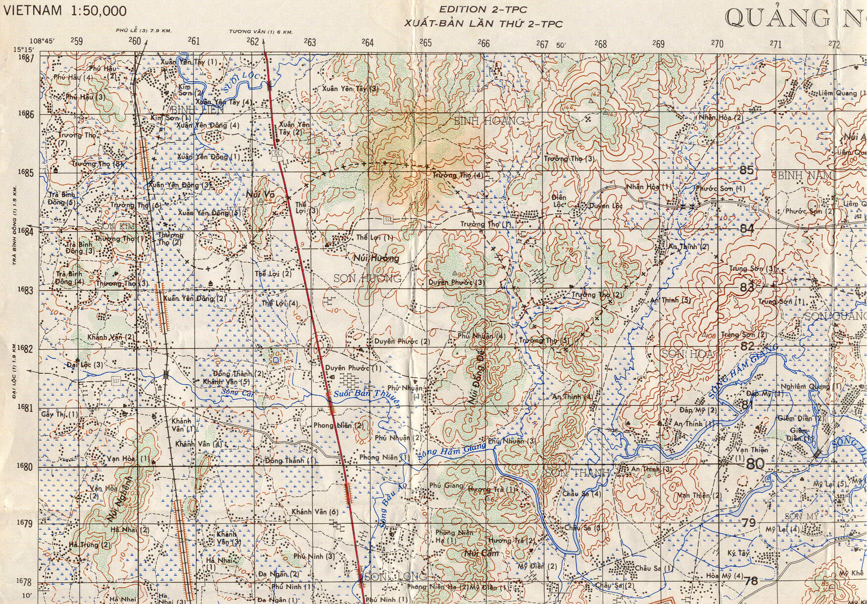
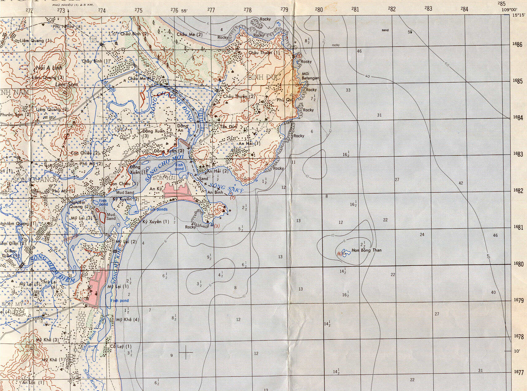
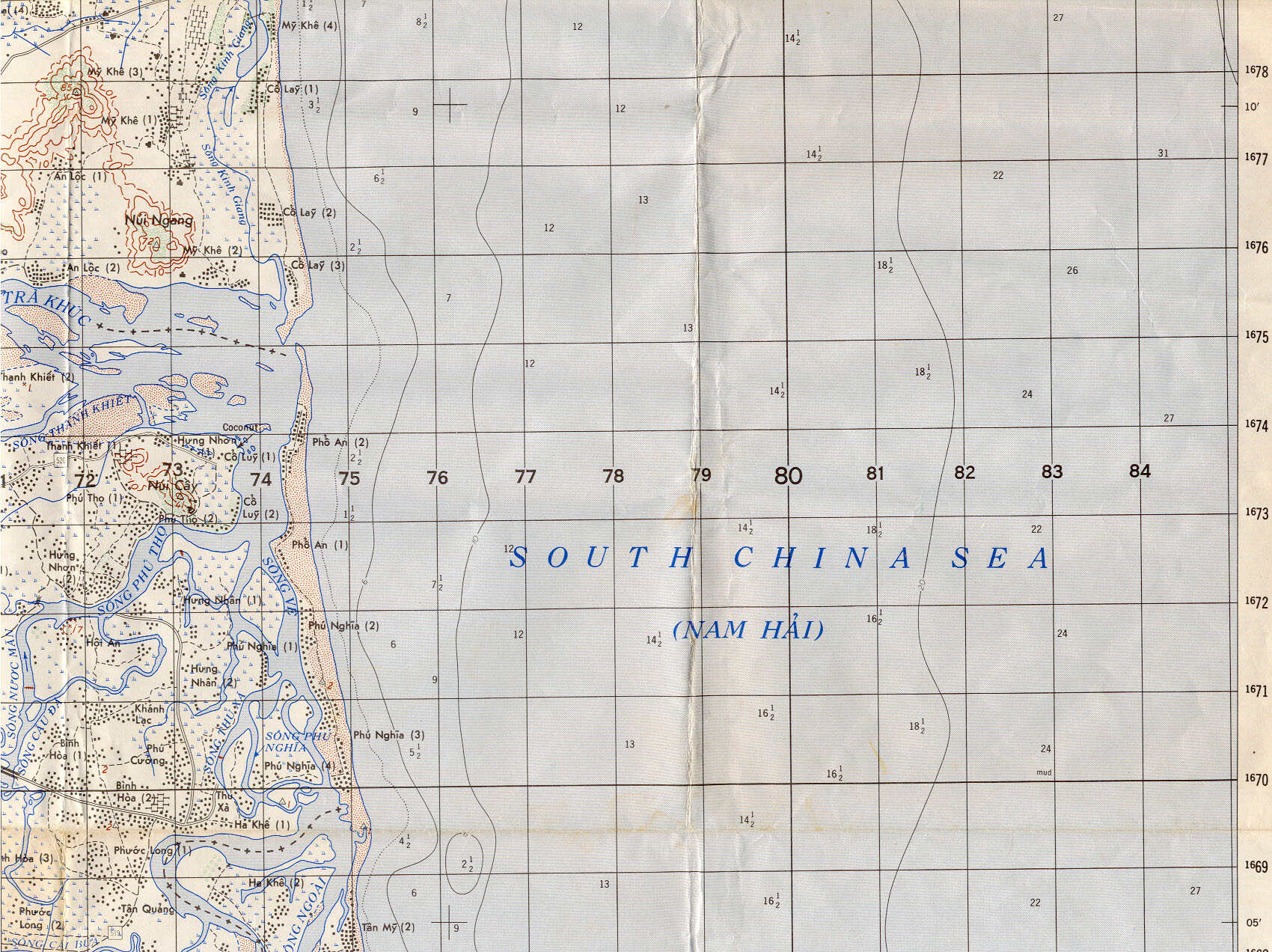
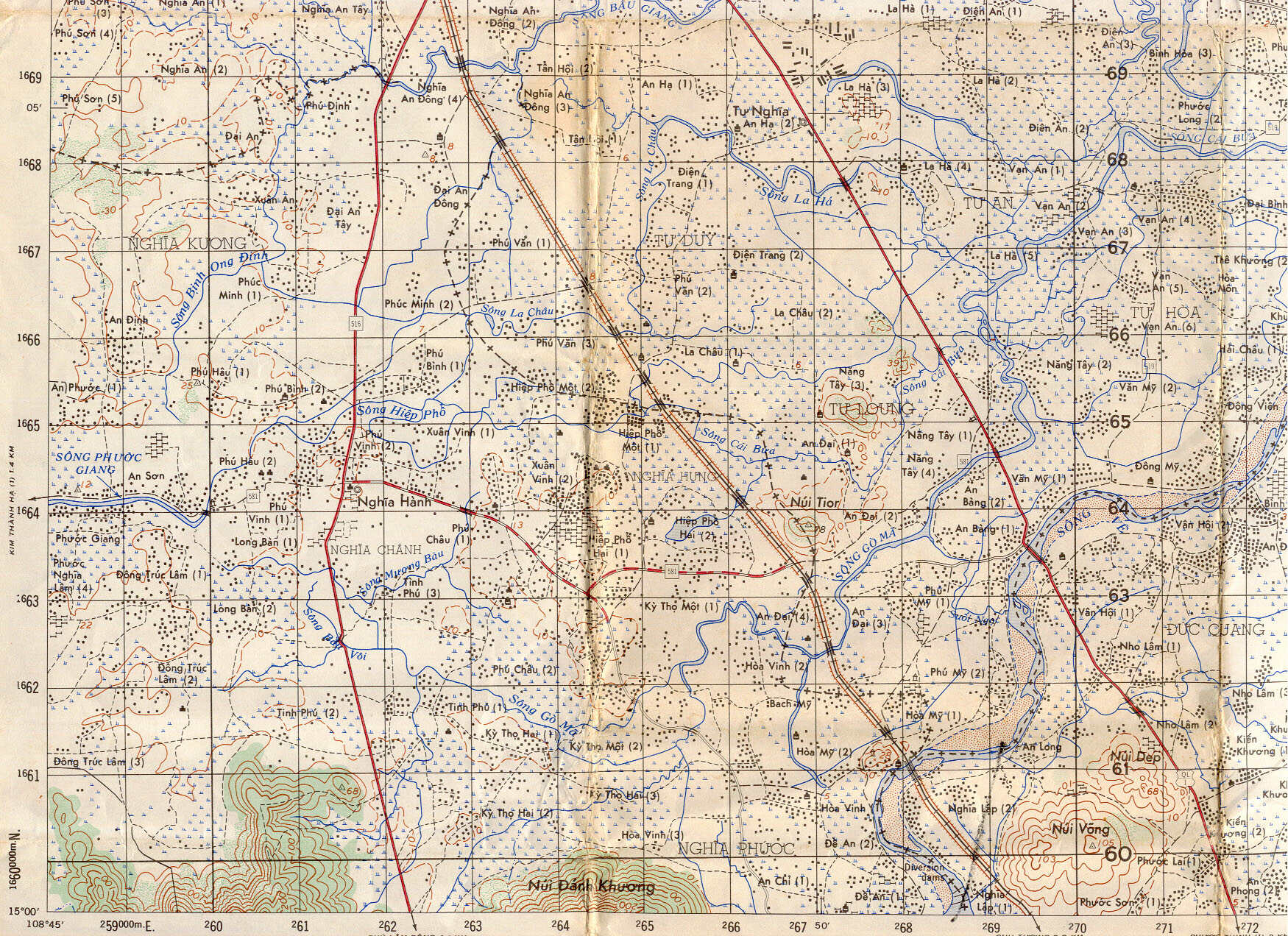
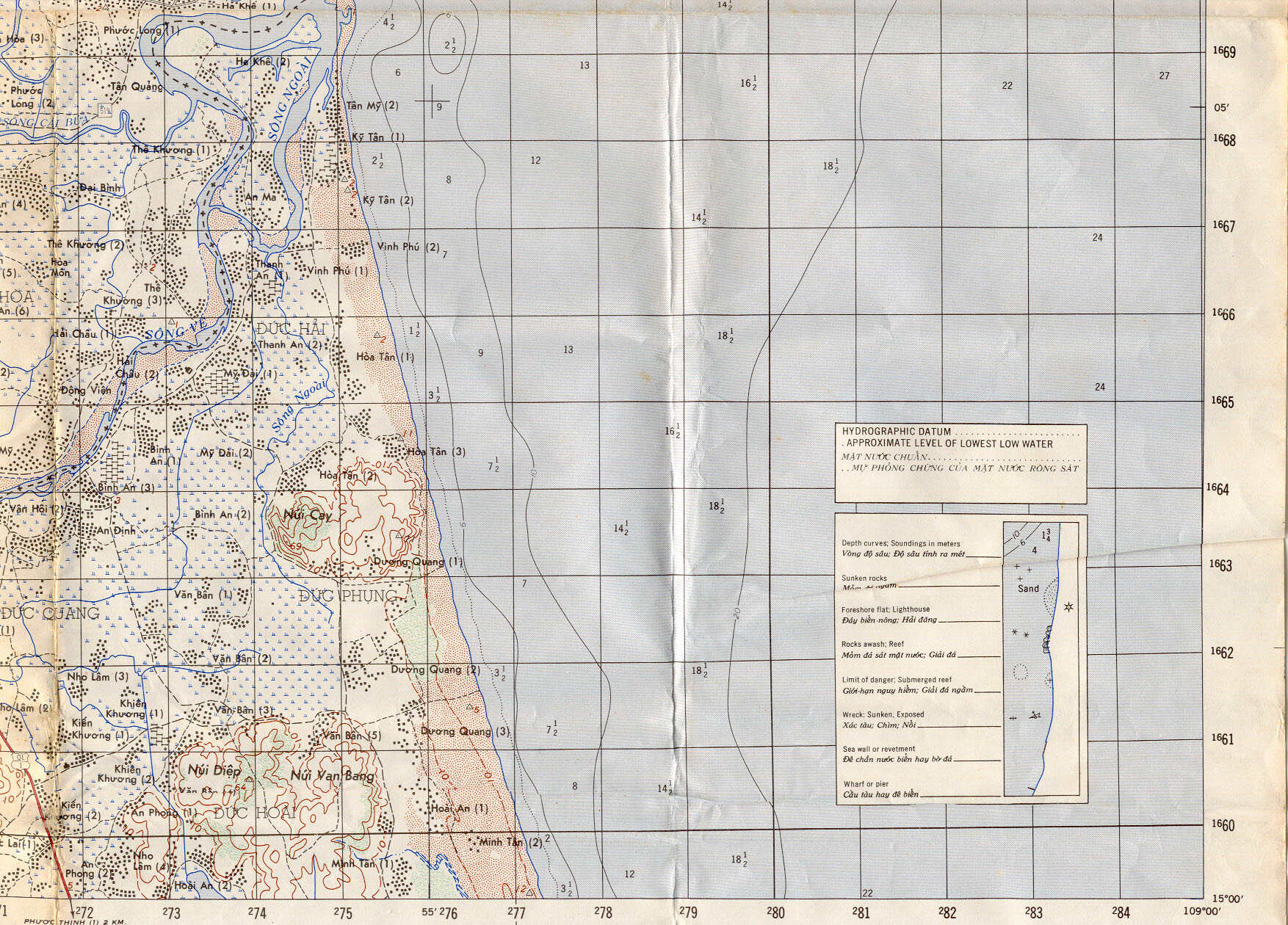
| Starting in March 1970, the 1st Bn 6th Inf tactical area of operational responsibility (TAOR) was the area east of Highway QL1 between Chu Lai and Quang Ngai. In early 1971, the TAOR expanded to include a large triangle shaped area bounded generally by Chu Lai on the north, Tra Bong on the west, Quang Ngai City on the south, and then eastward to the South China Sea. | Sheet 6739 - III Song Ha
|
Sheet 6739 - II Quang Ngai
|
||||||||||||||||||
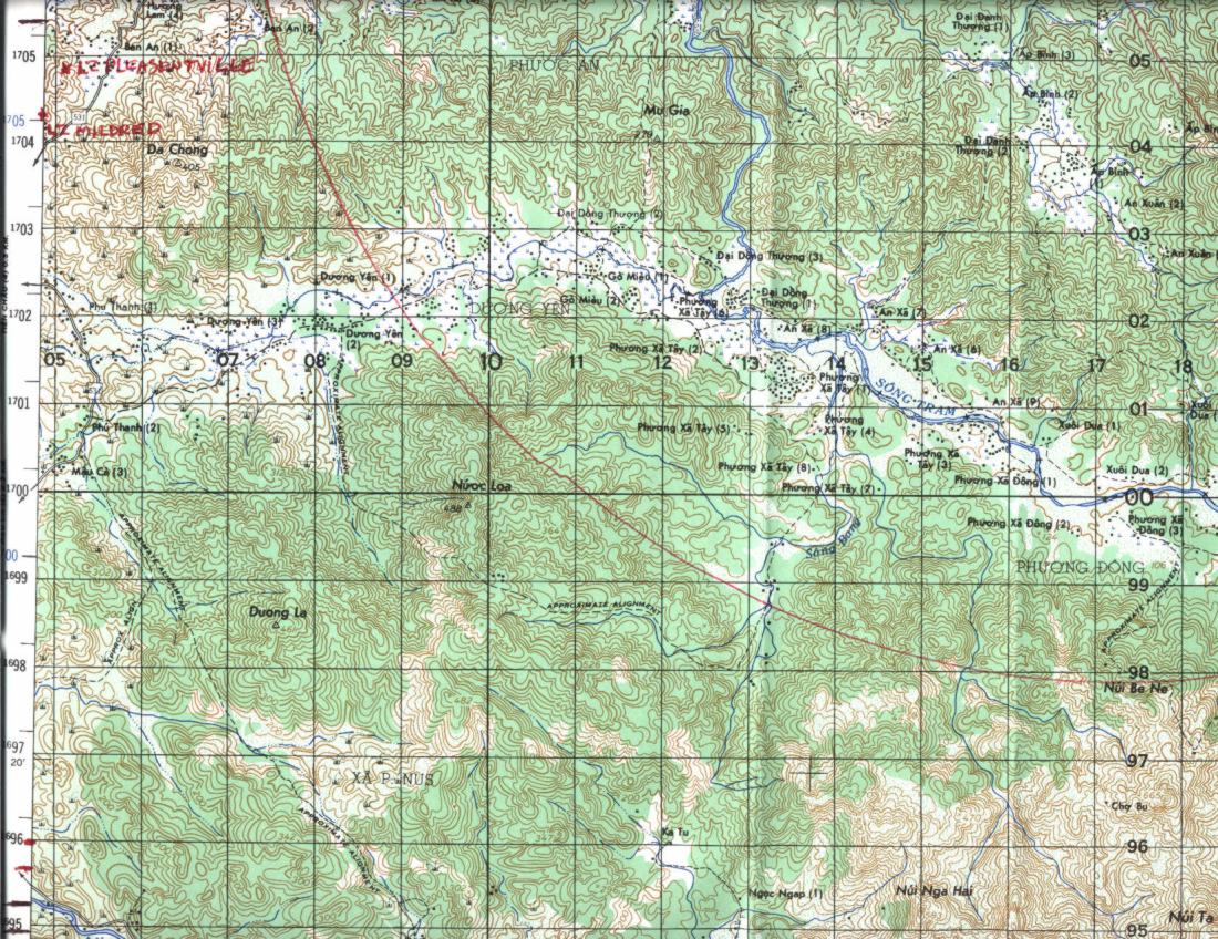
Landing Zone (LZ) and Fire Support Base (FSB) Locations and Map Links
The following list of LZ s and FSB s sometimes utilized by the 1st Bn
6th Inf are grouped by their
geographic location and are linked to the particular map sheet that
shows their location. Many of
these are 1980s vintage maps that have been marked carefully by Al
Simms, while others are earlier
versions. Click on the number to activate the link.
(1) Chu Lai, Artillery Hill, Cherry Hill, LZ Bayonet, LZ Bayonet West, LZ Gator, FSB/LZ Chippewa
(2) Americal Division HQ at Chu Lai, Hill 69
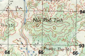
(3) Binh Son, FSB Nui Pho Tinh
(4) LZ Dottie (BS 630 855)
(5) LZ Fat City, Hill 54
(6) Hill 270, LZ Pineapple, Hill 410, Hill 707, FSB Bludgeon
(7) Tra Bong, LZ Cindy
(8) LZ Bowman (BT 239 142), LZ Clifford
Miscellaneous Maps and Map Links
Map of area of battle for Lo Giang, 1983 (1:50,000) (L-7014, 6640 IV, Dai Loc)
Hill 43 area (L-7014, 6739 I, Binh Son)
Area south of Nui Pho Tinh (L-7014,
6739 I, Binh Son)
Use browser back arrow or link to 1st Bn 6th Inf Home
Page


