Pacification
Ville. Van Thien (BS 696 804)
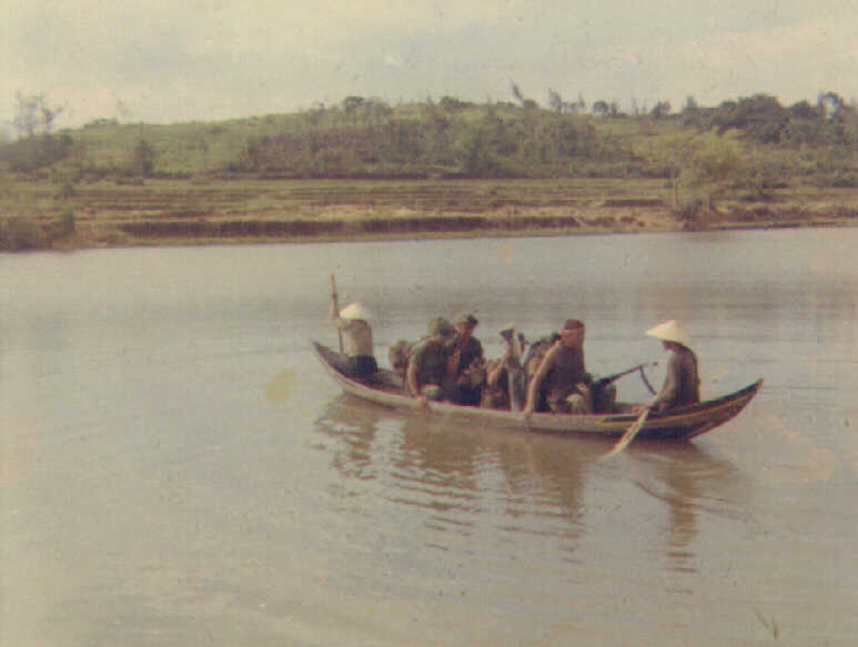
Soldiers from the 1st Bn
6th Inf catch a ride on a ferry boat across the Song Ham Giang near
Van Thien (BS 696 804).
1970 photo by Dennis Linn B/1-6 Inf, 70-71.
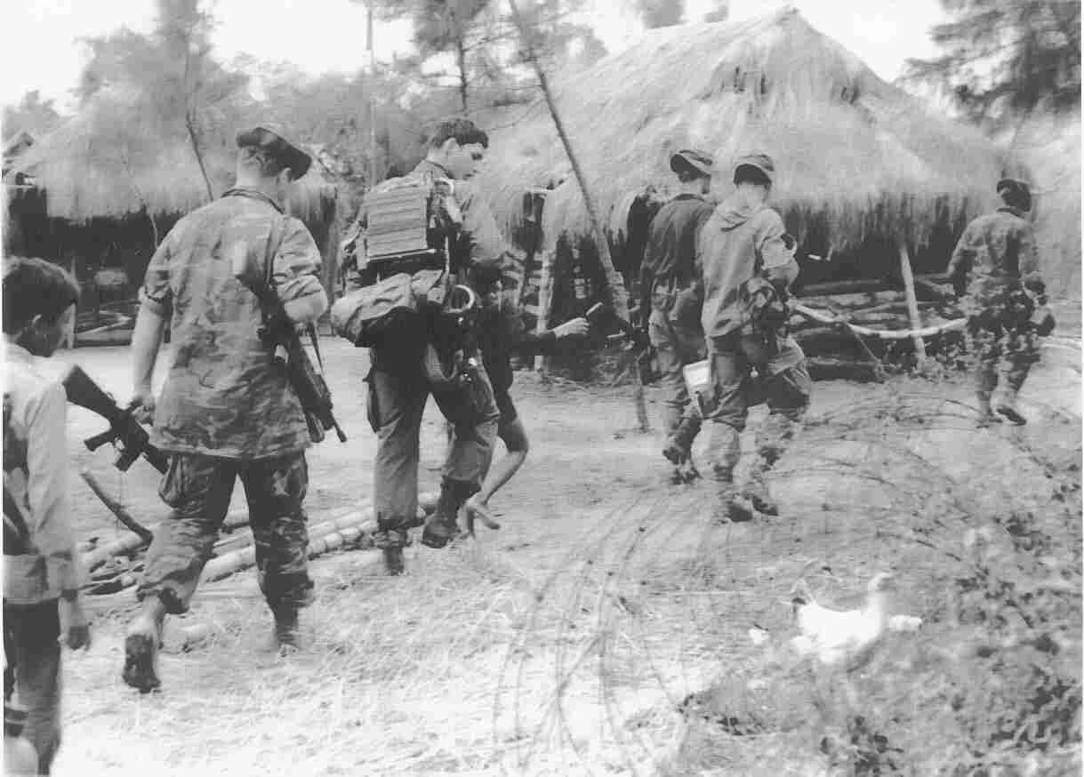
Official US Amry photo from
the National ArchivesII, #SC 660645, "Members of B Co., 1st Bn 6th Inf,
198th Light Infantry Brigade
join local Poplar Forces for a patrol near Van Thien. 19 Nov 70."
Contrary to
what the caption states,
these soldiers probably are returning from an LZ adjacent to the pacification
ville
where they received a resupply
of ammunition. Note absence of loadbearing equipment and grenades,
the ammunition box carried
by Ray Tyndall and Ray Mendez, the extra M-16 rifle, the radio carried
by
Underwood necessary to coordinate
with aircraft, and the presence of Vietnamese kids--all indications
that this was not a patrol.
The Combined Unit Pacification
Program (CUPP) that brought the soldiers to the village was a concept
to use a rifle company to
assist Popular Forces (PF) and People's Self Defense Forces (PSDF)
to
improve security in selected
hamlets and protect them from attack. The US forces were suposed
to help
the local forces in perimeter
defense, ambushes and patrols, and field sanitation. The effort was
of high
level interest. In
July 1970, the Secretary of the Army, the Hon. Stanley R. Resor, visited
the site.
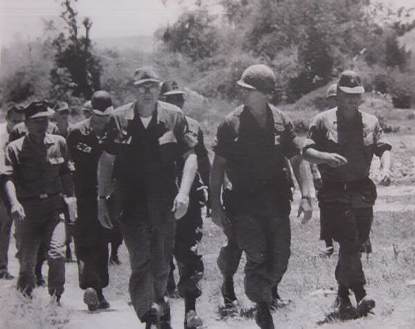
This official US Army photo
shows the distinguished guests accompanied by MAJ Robert Proctor, S-3,
1st Bn 6th Inf, (in helmet).
Photo from the National Archives II, College Park, MD.

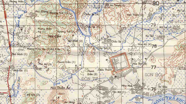
Pacification ville.
Looking south from the American position near the Van Thien pacification
ville. The
hazy outline of the eight
hundred meter long dirt fortifications of the old "French fort" are visible
in the
distance (looks like a long,
high levee).
[In 1970 we thought the
structure was an old French fortification designed to protect the inhabitants
from
direct fire, much like the
berms constructed at Hill 43 to protect land clearing equipment.
The fort was
far older--it was the Chau
Sa Citadel, built in the IXth century by the Champa people. It still
had walls 5m
high, and each side of the
large square fortification measured over 800m long. The Champa inhabited
the estuary of the Song
Tra Khuc river (flowing past the modern Quang Ngai city) from the IX to
the XIV
centuries. They lived
with rice cultivation, made pottery, and exchanged commodities with other
areas
of pre-colonial Vietnam.]
Enterprising villagers would
wait near the US defensive position to sell cold cokes, noodles and other
items
to the soldiers. Their
wares probably were purchased on the black market in Quang Ngai city and
then
carried over six miles to
the pacification ville. Photo provided by John Foster (4/B/1-6 Inf
1970-71)
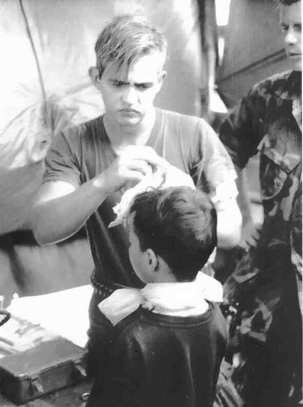
Part of the CUPP involved
medical support for the Vietnamese villagers. Here SP5 Harry Drick,
a medic in B Co., 1st Bn
6th Inf, treats a small boy during a MEDCAP operation in Van Thien
Vietnam, 21 Nov 70. Official
US Army photo SC 660646, National Archives II, College Park, MD.
Select additional photos
from the index at left or link to the 1st Bn 6th Inf Home
Page