Monastery, Nui Go Dam, and Hill 128
These 1970 photos of the Monastery, Nui Go Dam,
and Hill 128 show the terrain that was typical
in the 1st Bn 6th Inf tactical area during Operation
NANTUCKET BEACH from 22 Mar 1970 to
1 Mar 1971.
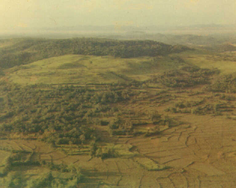
The "Monastery" east of LZ Dottie at BS 675 861
looking southward. The old ville of Tam Hoi (2)
is in the foreground. This 1970 photo shows
the checkerboard of vegetation that characterized the
lowlands in the 1st Bn 6th Inf tactical area.
These small plots were bounded on all sides by nearly
impenetrable hedges that limited visibility to
twenty or thirty meters. Sometimes the hedges
concealed well used trails. The steep hills
were covered by thick, jungle like growth. Three photos
furnished by Dennis Linn B/1-6 Inf 1970-71
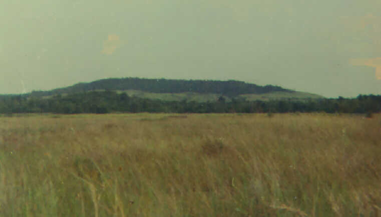
Nui Go Dam hill at BS 680 934 NE of LZ Dottie
in 1970. The open areas were covered with dense
grass that was four to six feet tall. Viet
Cong lookouts posted in the vegetation on the hill could keep
track of movement of US soldiers and aircraft.
This area was the scene of much combat from 1965
through 1970.

Helicopter view of land clearing operations in
the vicinity of Hill 128 in late September 1970. Note
the vertical tracks cut by the dozers on the
slopes in the right portion of the photo. Efforts to strip
the vegetation from the hills to deprive the
Viet Cong of places to hide were successful, as half of
the 200 enemy soldiers in the 48th Local Force
Battalion moves westward across QL1 in late
August 1970. Eventually, many of the hedges
on the low ground were stripped, but heavy rainfall
in October and November 1970 slowed the land
clearing efforts.

This 1971 photo, thought to be of the Monestary Hill (lower left),
shows the results of land clearing efforts.
Looking northwest.
Select additional photos from the index at left,
or link to the 1st Bn 6th Inf Home
Page.